Showing posts with label Rain /sun News. Show all posts

Sunday, February 21, 2021

Weathermen forecast more rain for 2 days

Weathermen forecast more rain for 2 days

TIMES NEWS NETWORK

Chennai:21.02.2021 

The city and its uburbs may receive more rain over Sunday and Monday after the surprise late night showers on Friday. While IMD has forecast light to moderate rain in some places in the state, weatherbloggers said chances of rainfall will reduce by Monday and will be followed by a dry spell till the end of the month.

IMD has forecast light to moderate rain over some areas with a generally cloudy sky for Sunday. The intensity of rain is likely to reduce in the subsequent 24 hours with the agency forecasting light rain over some areas. For the next two days, maximum and minimum temperatures are likely to be around 30°C and 23°C.

Light to moderate rain or thunderstorm with lightning is also likely at isolated places over Tamil Nadu on Sunday followed by light rain likely on Monday; according to the IMD.

On Friday, Nungambakkam recorded 2mm of rain and Meenambakkam received 1mm. February is the driest month of the year in the city with an average rainfall of 3.4mm. Some areas like Nungambakkam, Choolaimedu and Aminjikarai received rainfall on late Saturday evening.

IMD said the showers were caused by circulation in the westerlies in the upper level and in the lower level easterlies. While bloggers said shifting of the westerly trough — which usually affects north India — to the south has brought some weather disturbances resulting in rain, private forecasters said another trough is now extending from southwest Bay of Bengal to north Tamil Nadu and south Andhra Pradesh coast.

“Chennai has a good chance of some rain on Sunday. Rainfall will decrease by Monday,” said blogger Pradeep John.

Thursday, February 18, 2021

Chennai likely to get rain over weekend, but not over 5 mm

Chennai likely to get rain over weekend, but not over 5 mm

TIMES NEWS NETWORK

Chennai:18.02.2021

The cricket Tests ended just in time for the city to be treated to some showers. Weathermen have forecast light rain at the end of this week because of the easterlies strengthening in the presence of a cyclonic circulation.

While IMD has forecast light to moderate spells over a few places across the state, private forecasters and bloggers said Chennai and its suburbs may receive some spells at least for two days.

For the next 24 hours, IMD has forecast dry weather over Chennai and the rest of the state. The city and its neighbourhoods may record temperatures at a maximum of 31°C and a minimum of 22°C with partly cloudy skies. But by Friday, the agency has forecast light rain at isolated places over coastal Tamil Nadu while dry weather may prevail over rest of the state. On Saturday and Sunday, the intensity is likely to increase as light to moderate rain with thunderstorms have been forecast at a few places over the state. Experts said the spells would be due to a cyclonic circulation over southwest Bay of Bengal and Sri Lanka ,which is likely to strengthen the incoming easterly winds to the state.

Skymet weather, in an online post, said rain and thundershowers are expected all along the coastline from Chennai to Kanyakumari between Friday and Sunday. “The quantum of rain is not going to exceed 5mm in this wet spell,” the forecaster also said.

Climatologically, the city is comparatively dry during February as it receives an average 3.4mm, which is the lowest amount of rainfall in the year.

Weather blogger Pradeep John in his post said the westerly trough, a region of elongated low pressure in the westerly winds, which usually affects north India may at times move down to south India bringing some weather activity. “Unlike monsoon spells, these rains are difficult to forecast as they do not occur in a widespread area,” he said. After Sunday, a prolonged dry spell till the end of February is likely.

Tuesday, May 19, 2020

Heavy rain hits crops in Trichy, Thanjavur


Heavy rain hits crops in Trichy, Thanjavur

19.05.2020

Trichy: Heavy rain accompanied by gale destroyed hundreds of banana palms in Trichy and paddy crops in Thanjavur district on Sunday. The crops were ready for harvest. Meanwhile, officials from the horticulture department began to assess the damage.

Heavy rains with strong winds lashed many parts of the district causing damage to hundreds of banana trees in Vayalur and Kuzhumani, Somarasampettai and Thottiam. The rain continued for more than an hour in the night on Sunday. Farmers have cultivated Poovan and Nei Poovan variety on hundreds of acres.

Though people in the district had been expecting summer rain, the sudden rain with the gale caused trouble to the banana farmers.

However, as almost all the banana bunches were ready for harvest, they could sell them, the officials said. Meanwhile, revenue officials visited the area and assured them help. TNN

Sunday, May 17, 2020

Odisha gears up for cyclone


Odisha gears up for cyclone

Districts on alert though it may head for the Bengal coast

17/05/2020, SATYASUNDAR BARIK,BHUBANESWAR

The Odisha government on Saturday said it would not to be complacent in its preparation even if initial analysis of the impending cyclone’s track suggests that the system might spare the State.

Chief Minister Naveen Patnaik held videoconferencing with senior officials of 12 districts to take stock of the situation. He asked the District Collectors to put extra efforts for preparedness and try to ensure zero casualty.

Earlier in the day, Chief Secretary Asit Tripathy briefed Cabinet Secretary Rajiv Gauba about the State’s preparedness.

As per the predicted path of the cyclone, around seven lakh people in 649 villages along the sea coast are likely to be severely affected. Standing crops in lakhs of hectares particularly, ripe summer paddy, pulses and oil seeds, cashew, mango, coconut and vegetables are likely to be damaged, said the government.

“Around 403 cyclone shelters have been identified in the area. Around 105 such shelters are presently being used as quarantine centres for COVID care. Tests of the persons accommodated in these centres are being done expeditiously so that those with negative report can be sent for home quarantine,” said Mr. Tripathy. As a contingency arrangement, alternative buildings were identified, he said.

It is suspected that Balasore, Bhadrak, Kendrapara and Jagatsinghpur could be hit by the cyclone.

Monday, May 4, 2020

அக்னி நட்சத்திரம் இன்று துவக்கம் ; 'டாப் கியரில்' வெயில் சுட்டெரிக்கும்

Added : மே 04, 2020 00:17

சென்னை : கத்திரி வெயில் காலமான, அக்னி நட்சத்திரம் இன்று துவங்குகிறது; வரும், 28 வரை தொடர்வதால், தமிழகம், புதுச்சேரியில், வெயில் சுட்டெரிக்கும் அபாயம் உள்ளது.

'காலை, 11:00 முதல், பகல், 3:30 மணி வரை, வெயிலில் வேலை செய்வதையும், அலைவதையும் தவிர்க்க வேண்டும்' என, சென்னை வானிலை ஆய்வு மையம் எச்சரித்துள்ளது. ஆண்டுதோறும், மார்ச், ஏப்ரல், மே மாதங்கள் கோடை காலம். ஜூனில் தென்மேற்கு பருவமழை துவங்கும்.கேரளாவில் துவங்கும் இந்த மழை, ஜூன், ஜூலை மாதங்களில், கேரளா, தமிழகம், கர்நாடகா, மஹாராஷ்டிரா என, ஜம்மு - காஷ்மீர் வரை பரவும்.பருவமழை துவங்க, இன்னும் ஒரு மாதமே உள்ள நிலையில், கோடை வெயில் தீவிரமாகியுள்ளது.

கத்திரி வெயில் காலமான, அக்னி நட்சத்திரம் இன்று துவங்குகிறது; வரும், 28 வரை நீடிக்கும். இதனால், தமிழகம் மற்றும் புதுச்சேரியில், வெயில் சுட்டெரிக்கும் வாய்ப்புள்ளது.'அக்னி நட்சத்திர காலத்தில், மற்ற நாட்களை விட, வெயில் அதிகரிக்கும்' என, ஜோதிட சாஸ்திர அடிப்படையில் கூறப்படுகிறது. அதன்படியே, இந்த காலத்தில் வெயில் வறுத்தெடுத்து வருகிறது.ஆனால், வானிலை ஆய்வு மையத்தின், அறிவியல் ரீதியான ஆராய்ச்சி கணிப்பில், கத்திரி வெயில் குறித்து, எந்த தனிப்பட்ட அறிவிப்பும் வெளியிடப்படுவதில்லை.

இந்நிலையில், சென்னை வானிலை ஆய்வு மையம் கூறியுள்ளதாவது: வங்க கடலில், காற்றழுத்த தாழ்வு பகுதி நிலவுவதால், அடுத்த நான்கு நாட்களுக்கு, தமிழகம் மற்றும் புதுச்சேரியின் கடலோர மாவட்டங்களில், பலத்த காற்று வீசும்.ஆனாலும், வறண்ட வானிலையே நிலவும். கடலோரம் அல்லாத, தமிழக உள் மாவட்டங்களில், சில இடங்களில் வெப்பச் சலன மழை பெய்யலாம். சென்னையில் அதிகபட்சமாக, 37 டிகிரி செல்ஷியஸ் வரை வெயில் பதிவாகும். கரூர், திருச்சி, மதுரை, சேலம், தர்மபுரி உள்ளிட்ட மாவட்டங்களில், இன்று, 41 டிகிரி செல்ஷியஸ் வரை வெயில் எகிறலாம்.எனவே, காலை, 11:00 முதல், பகல், 3:30 மணி வரை, வெயிலில் வேலை செய்வதையும், அலைவதையும் தவிர்க்க வேண்டும். இவ்வாறு, அந்த மையம் கூறியுள்ளது.

Thursday, April 9, 2020

15 மாவட்டங்களில் இன்று கனமழைக்கு வாய்ப்பு

By DIN | Published on : 09th April 2020 04:11 AM 

தமிழகத்தில் திருநெல்வேலி, ராமநாதபுரம், கடலூா், விழுப்புரம் உள்ளிட்ட 15 மாவட்டங்களில் வியாழக்கிழமை கனமழைக்கு வாய்ப்பிருப்பதாக சென்னை மண்டல வானிலை ஆய்வு மையம் தெரிவித்துள்ளது.

இதுகுறித்து வானிலை ஆய்வு மைய அதிகாரி கூறியதாவது:

தமிழகத்தில் பல்வேறு மாவட்டங்களில் கடந்த சில நாள்களாக வெப்பநிலை படிப்படியாக அதிகரித்து வருகிறது. இதன் தாக்கம் பகலில் உணரப்படுகிறது. பல இடங்களில் காலை 9 முதல் பிற்பகல் 3 மணி வரை வெயில் சுட்டெரித்து வருகிறது.

இதற்கிடையே வெப்பச்சலனம் காரணமாக ஒரு சில இடங்களில் அவ்வப்போது மழையும் பெய்து வருகிறது.

இதன் தொடா்ச்சியாக திருநெல்வேலி, தூத்துக்குடி, விருதுநகா், ராமநாதபுரம், மதுரை, சிவகங்கை, புதுக்கோட்டை, திருச்சி, தஞ்சாவூா், திருவாரூா், பெரம்பலூா், அரியலூா், நாகப்பட்டினம், கடலூா், விழுப்புரம் உள்ளிட்ட 15 மாவட்டங்களில் ஒரு சில இடங்களில் வெப்பச்சலனம் காரணமாக வியாழக்கிழமை கனமழை பெய்ய வாய்ப்புள்ளது.

சென்னையைப் பொருத்தவரை வானம் மேகமூட்டத்துடன் காணப்படும். அதிகபட்சமாக 95 டிகிரி பாரன்ஹீட் மற்றும் குறைந்தபட்சமாக 82.4 டிகிரி பாரன்ஹீட் பதிவாக வாய்ப்புள்ளது.

5 இடங்களில் வெயில் சதம்: தமிழகத்தைப் பொருத்தவரை அதிகபட்சமாக மதுரை விமான நிலையத்தில் 103 டிகிரியும், திருச்சி மற்றும் மதுரையில் தலா 101 டிகிரியும், திருத்தணி மற்றும் கரூா் பரமத்தியில் தலா 100 டிகிரியும் புதன்கிழமை வெயில் அளவு பதிவானது.

Saturday, April 4, 2020

Summer is likely to be normal in Tamil Nadu, say weathermen

TNN | Apr 3, 2020, 09.16 AM IST

CHENNAI: If you are already worried about mounting electricity bills after working from home for weeks with the air-conditioners turned on, weathermen's seasonal forecast may bring some comfort. The overall summer season is going to be normal.

While the average temperatures for the season from April to June is likely to be normal across the state, experts said there may be a sudden spike in temperatures for a day or two during the season.

According to India Meteorological Organisation's seasonal outlook for April to June, the state may experience normal maximum temperatures with a slight departure from normal which will be within -0.5°C to 0.5°C. The average maximum temperatures for the three months including peak month of May is generally likely around 34°C to 37°C.

N Puviarasan, director, Area Cyclone Warning Centre, IMD, said there will be days when the maximum temperatures could fluctuate and see a sudden spike, but they may not last for longer periods. "The seasonal forecast calculates the average for the season from April to June, which for us is going to be normal for us. There will be days when the temperatures could reach two or three degrees above normal. But they may last only for two or three days followed by a sudden drop below normal. These day to day variations will be there," he said.

The regional meteorological centre has forecast that "the sky condition is likely to be mainly clear. Maximum and minimum temperatures is likely to be around 35°C and 26°C," in the city for the next 48 hours.

Friday, March 20, 2020

சேலம், நாமக்கல்லில் சதம் அடித்த வெயில்

Added : மார் 20, 2020 01:24

சென்னை : திருத்தணி, சேலம், நாமக்கல் நகரங்களில், 100 டிகிரி பாரன்ஹீட் அளவுக்கு, நேற்று வெயில் கொளுத்தியது. நாளை முதல், சில இடங்களில் லேசான மழைக்கு வாய்ப்புள்ளது.

தமிழகம் மற்றும் புதுச்சேரியில், நேற்று மாலை, 5:30 மணி நிலவரப்படி, திருத்தணி, சேலம் மற்றும் நாமக்கல் ஆகிய நகரங்களில், 100 டிகிரி பாரன்ஹீட் வெயில் பதிவானது. சென்னை, நுங்கம்பாக்கம், 34; விமான நிலையம், 35 டிகிரி செல்ஷியஸ் வெப்பம் பதிவானது. கோவை, தர்மபுரி, கரூர் பரமத்தி, மதுரை, திருச்சி, வேலுார், 37; தொண்டி, 36; பாளையங்கோட்டை, 35; பரங்கிப்பேட்டை, புதுச்சேரி, 34; கடலுார், காரைக்கால், பாம்பன், துாத்துக்குடி, 33; கன்னியாகுமரி, நாகை, 32; வால்பாறை, 30 குன்னுார், 25; ஊட்டி, 24; கொடைக்கானல், 20 டிகிரி செல்ஷியஸ் வெயில் பதிவானது.

இன்றைய வானிலையை பொறுத்தவரை, தமிழகம் மற்றும் புதுச்சேரியில் வெயில் நீடிக்கும்; பெரும்பாலான இடங்களில், வறண்ட வானிலை நிலவும். நாளை முதல் மூன்று நாட்களுக்கு, தமிழகம் மற்றும் புதுச்சேரியில், லேசான மழைக்கு வாய்ப்புள்ளது. வட மாவட்டங்களில், காற்றின் திசை மாறுபடுவதால், திடீர் மழைக்கு வாய்ப்பு இருப்பதாக, வானிலை மையம் கூறியுள்ளது.

Saturday, February 29, 2020


மார்ச் முதல் மே வரை வெயில் கொளுத்தும்

Updated : பிப் 29, 2020 02:00 | Added : பிப் 29, 2020 01:59

புதுடில்லி, :இந்தியாவில், வரும் மார்ச் முதல், மே வரை, வெப்பம் வழக்கத்தை விட அதிகமாக இருக்கும் என, வானிலை ஆய்வு மையம் தெரிவித்துள்ளது.

இந்திய வானிலை ஆய்வு மையம், நேற்று அளித்த தகவலின் அடிப்படையில், இந்தியாவின் மேற்கு, வடமேற்கு, மத்திய மற்றும் தென் பகுதிகளில் மார்ச் முதல், மே வரை, வழக்கத்திற்கு மாறாக வெப்பநிலை அதிகமாக பதிவாகும். பஞ்சாப், ஹிமாச்சல பிரதேசம், டில்லி, உத்தரகண்ட், ஹரியானா, ராஜஸ்தான், உத்தர பிரதேசம், குஜராத், மத்திய பிரதேசம், பீஹார், சத்தீஸ்கர், ஜார்கண்ட், மேற்கு வங்கம், ஒடிசா, தெலுங்கானா, மஹாராஷ்டிரா மற்றும் கடலோர ஆந்திராவின் சில பகுதிகளிலும், வழக்கத்தை விட வெப்பம் கூடுதலாக இருக்கும்.

இந்தியாவின் மற்ற பகுதிகளுடன் ஒப்பிடும் போது, தமிழகத்தில் குறைந்த அளவு மட்டுமே வெப்பம் அதிகரிக்கும். வடமேற்கு, மேற்கு மற்றும் மத்திய இந்தியாவில், கடும் அனல் காற்று வீசுவதற்கும் வாய்ப்புள்ளது.

Thursday, December 26, 2019

New Year cheer: Expect some rain in Jan

NE Monsoon Extending Till January

TIMES NEWS NETWORK

Chennai:26.12.2019

The city’s residents are likely to ring in the New Year carrying umbrellas or wearing raincoats. The weatherman says an extended northeast monsoon could bring cloudy skies and light rain in January 2020.

“This time northeast monsoon is extending to January and because of that, we can see light rain in the coastal districts in the first week of the month,” said N Puviarasan, director, Area Cyclone Warning Centre, Regional Meteorological Centre, Chennai.

Weather bloggers too have forecast rainfall in January.

“There is some light rain expected around new year for Kancheepuram, Tiruvallur, Chennai and there is also some rain in January first week,” Pradeep John posted in his online update.

This, according to experts, is because of the flow of the easterlies, which normally begins to decline by December.

While meteorologists said it is normal for the monsoon to extend beyond December, this year the southwest monsoon, which was supposed to begin withdrawing in September, ended only by mid-October. The southwest monsoon withdrawal, which takes place over a month, was rapid and northeast monsoon began within a few days by October 16.

However, the rain forecast for early next month may not make up much of the monsoon deficit in the city. As of Wednesday, Chennai has recorded 613.3mm rain so far this monsoon season against the average 740.4mm, leaving a deficit of 17%.

“The rain next month could bring down the deficit by one or two percentage points, not more than that. It could last for four or five days,” an IMD official said.

For the next 48 hours, IMD has forecast the sky condition likely to be generally cloudy and light rain likely to occur in some areas. Maximum and minimum temperatures likely to be around 30 and 25 deg C.

IMD had forecast light rain for the last two days, but the city only recorded a trace — around 2mm of rainfall. These conditions, experts said, are likely to continue till the end of this year.

Mahesh Palawat, chief meteorologist, Skymet weather, said a cyclonic circulation in the Comorin region extending up to southern Tamil Nadu could bring moderate rainfall in southern districts and isolated spells in the northern districts of the state for the next two days. “Chances of rain around New Year are very slim,” he said.

Since there was no rain and the sky was clear, the temperature touched 30 degree Celsius on Wednesday while it was around 26 degree Celsius on Tuesday because the sky was cloudy and there was a drizzle.

A met official said temperatures will fall only if the day is cloudy.


BE RAIN-READY: Weathermen said Chennai, Kancheepuram and Tiruvallur will receive rain in the first week of January

Tuesday, December 3, 2019

மாவட்ட செய்திகள்

தொடர் மழையால் வெள்ளத்தில் மிதக்கும் சென்னை புறநகர்


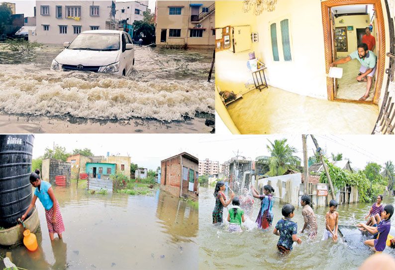
தொடர்ந்து பெய்து வரும் மழையால் சென்னை புறநகர் பகுதிகள் வெள்ளத்தால் சூழப்பட்டு உள்ளது. வீடுகளை மழைநீர் சூழ்ந்ததால் உறவினர் வீடுகளில் பொதுமக்கள் தஞ்சம் அடைந்தனர். மேலும் பாம்புகள், அட்டை பூச்சிகள் நடமாட்டத்தாலும் அச்சம் அடைந்துள்ளனர்.

பதிவு: டிசம்பர் 03, 2019 05:00 AM
சென்னை,

கடந்த ஆண்டு பருவமழை பொய்த்து போனதின் விளைவாக ஏரிகள் வறண்டன. நிலத்தடி நீர்மட்டமும் வெகுவாக குறைந்து, தலைநகர் சென்னையில் இதுவரை இல்லாத அளவுக்கு குடிநீர் தட்டுப்பாடு பிரச்சினை உருவானது. இதனால் இந்த ஆண்டு வடகிழக்கு பருவமழையை மக்கள் பெரிதும் நம்பி இருந்தனர்.

அவர்களின் நம்பிக்கையை கெடுக்காத வகையில் மழையும் பெய்து வருகிறது. கடந்த சில நாட்களாக சென்னை மற்றும் புறநகர் பகுதிகளில் நல்ல மழை பெய்து வருகிறது. குறிப்பாக கடந்த 30-ந்தேதி நள்ளிரவு முதல் மறுநாள் இரவு வரை கனமழை பெய்தது.

அந்தவகையில் சென்னை நகர் பகுதிகளில் நல்ல மழை பெய்துள்ளது. அதேபோல முடிச்சூர், தாம்பரம், மடிப்பாக்கம், வேளச்சேரி, பள்ளிக்கரணை, சோழிங்கநல்லூர், பெருங்களத்தூர், ஊரப்பாக்கம், கூடுவாஞ்சேரி, ஆலந்தூர், நங்கநல்லூர், துரைப்பாக்கம் உள்ளிட்ட புறநகர் பகுதிகளிலும் மழை கொட்டித்தீர்த்தது.

தொடர் மழை காரணமாக தாழ்வான பகுதியில் உள்ள வீடுகளுக்குள் மழைநீர் புகுந்ததால் பொதுமக்கள் அவதிக்குள்ளாகினர். மடிப்பாக்கம் ராம்நகரில் வீடுகளை சூழ்ந்து குளம்போல் மழைநீர் தேங்கி கிடக்கிறது. விட்டுவிட்டு மழை பெய்து வருவதால் தேங்கிய மழைநீரை அப்புறப்படுத்த முடியாமல் பரிதவிக்கும் மக்கள், மேற்கொண்டு என்ன செய்வதென்று தெரியாமல் தவித்து வருகிறார்கள்.

அந்த பகுதிகளில் பாதாள சாக்கடையில் அடைப்பு ஏற்பட்டிருப்பதால் மழைநீர் வடியாமல் தெருக்களை சூழ்ந்து கொண்டிருக்கிறது. இதனால் பல குடும்பங்கள் வீட்டை பூட்டிவிட்டு உறவினர் வீடுகளுக்கு சென்றுவிட்டனர். சிலர் மொட்டை மாடிகளில் தஞ்சம் அடைந்துள்ளனர்.

மழைநீரில் பாம்புகள், அட்டை பூச்சிகள் நடமாட்டமும் இருப்பதால் அச்சத்துடனே அப்பகுதி மக்கள் இருக்கிறார்கள். தெருக்கள் முழுவதும் மழைநீர் சூழ்ந்துள்ளதால் கடைகளுக்கு செல்ல கூட முடியாமல் மக்கள் தவிப்பதை பார்க்க முடிகிறது.

பள்ளிக்கரணையிலும் இதே நிலைதான் ஏற்பட்டிருக்கிறது. குறிப்பாக அங்குள்ள காமகோட்டி நகர், காமாட்சி நகரில் குடியிருப்பு பகுதிகளில் குளம்போல மழைநீர் சூழ்ந்து உள்ளது. வீடுகளில் மழைநீர் புகுந்து மக்களை தவிக்க வைத்திருக்கிறது.

இதனால் மக்களின் இயல்பு வாழ்க்கை பெரிதும் பாதிக்கப்பட்டு உள்ளது. தாழ்வான பகுதிகளில் உள்ள வீடுகள் பெரிதும் பாதிக்கப்பட்டு உள்ளன. இடுப்பளவு தேங்கிய நீரை கடந்தே மக்கள் எங்கும் செல்ல வேண்டிய நிலை இருக்கிறது.

காமகோட்டி நகரில் உள்ள மாநகராட்சி பூங்கா மழைநீரால் சூழப்பட்டு தீவு போல காட்சியளிக்கிறது. இருசக்கர வாகனங்கள், கார்கள் போன்றவை சாலையில் நிறுத்தி வைக்கப்பட்டு உள்ளது.

சிட்லபாக்கம் நேதாஜி நகரிலும் மழைநீர் பிரச்சினையில் குடியிருப்புவாசிகள் பரிதவிக்கிறார்கள். குளம்போல தேங்கியுள்ள மழைநீரில் சிறுவர்-சிறுமிகள் ஆட்டம் போட்டு வருகிறார்கள். மழைநீர் சூழ்ந்ததால் 200-க்கும் மேற்பட்ட குடும்பங்கள் அங்கிருந்து உறவினர் வீடுகளுக்கு இடம்பெயர்ந்து விட்டனர்.

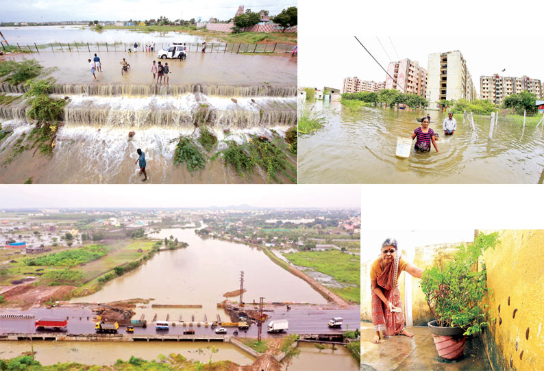
பெரும்பாக்கம் அருகே ஏரிநீர் சாலையில் வெள்ளம்போல செல்கிறது. அதில் சிறுவர்கள், இளைஞர்கள் மீன், நண்டு பிடித்து மகிழ்ச்சி அடைகின்றனர். பெரும்பாக்கம் பிரதான சாலையில் வெள்ளம் பால மழைநீர் செல்வதால் அங்கு வாகனங்கள் செல்வதில் சிரமம் ஏற்பட்டு உள்ளது. சிலரது எச்சரிக்கையை மீறி சென்ற வாகன ஓட்டிகளும் ஒருகட்டத்தில் மழைநீரில் பரிதவித்த காட்சியை பார்க்க முடிந்தது.

இதேபோல ஆதம்பாக்கம், நங்கநல்லூர், புழுதிவாக்கம், கோவிலம்பாக்கம் பகுதிகளிலும் குடியிருப்பு பகுதிகளை மழைநீர் சூழ்ந்துள்ளது. தேங்கியுள்ள மழைநீரை உடனடியாக அப்புறப்படுத்தக்கோரி அப்பகுதி மக்கள் வேண்டுகோள் விடுத்துள்ளனர்.
பூந்தமல்லியை அடுத்த காட்டுப்பாக்கம் ஊராட்சிக்கு உட்பட்ட இந்திராநகர், பி.ஜி.அவென்யூ, ஸ்ரீ நகர், அடிசன் நகர், அம்மன் நகர் உள்ளிட்ட பல்வேறு பகுதிகளில் மழைநீர் தேங்கி உள்ளது. மழை நீரோடு குப்பைகள், கழிவுநீரும் சேர்ந்து துர்நாற்றம் வீசுகிறது. மின் மோட்டார்கள் மூலம் மழைநீரை வெளியேற்றும் பணி நடந்தாலும் மோட்டார்களில் பிளாஸ்டிக் பைகள் சிக்கிக்கொள்வதால் மழைநீரை வெளியேற்றுவதில் சிக்கல் ஏற்பட்டு உள்ளது.

வீடுகளை மழைநீர் சூழ்ந்து உள்ளதால், மழை நீரோடு விஷ பூச்சிகளும் வீடுகளுக்குள் படையெடுக்கிறது. இதனால் குழந்தைகளுடன் பொதுமக்கள் அசத்துடன் தவித்து வருகின்றனர். சிலர் தங்களது வீடுகளை பூட்டிவிட்டு உறவினர்கள் வீடுகளில் தஞ்சம் அடைந்தனர். சிலர் தேங்கி உள்ள மழைநீரில் தங்கள் வாகனங்களை கழுவி வருகின்றனர்.

மழை நீரால் சூழ்ந்த காட்டுப்பாக்கம் ஊராட்சிக்குட்பட்ட பகுதிகளில் வெள்ள தடுப்பு கண்காணிப்பு அதிகாரி ஜெயந்தி நேற்று ஆய்வு செய்தார். வீடுகளை சூழ்ந்து இருக்கும் மழைநீரை வெளியேற்ற நடவடிக்கை எடுக்கும்படி அதிகாரிகளிடம் அவர் தெரிவித்தார்.

காஞ்சீபுரம் மாவட்டம் ஆதனூரில் தொடங்கும் அடையாறு ஆறு மண்ணிவாக்கம், முடிச்சூர், வரதராஜபுரம், பெருங்களத்தூர், திருநீர்மலை, திருமுடிவாக்கம், அனகாபுத்தூர், கவுல்பஜார், மணப்பாக்கம், ஈக்காடுதாங்கல், சைதாப்பேட்டை, கோட்டூர்புரம், பட்டினப்பாக்கம் வழியாக 42.5 கிலோ மீட்டர் தூரம் பயணித்து பட்டினப்பாக்கம் சீனிவாசபுரம் அருகே வங்க கடலில் கலக்கிறது.

தற்போது பெய்துவரும் தொடர் மழையால் அடையாறு ஆற்றில் வெள்ளம் கரை புரண்டு ஓடுகிறது. இதனால் பம்மல் அடுத்த கவுல்பஜார் அருகே உள்ள தரைப்பாலத்தின் மேல் ஒரு அடி உயரத்துக்கு வெள்ளம் ஓடுகிறது. மேலும் மழை தொடரும் பட்சத்தில் தரைப்பாலம் மூழ்கும் நிலை உள்ளது.

குரோம்பேட்டை அரசு ஆஸ்பத்திரியின் கீழ்தளத்தில் முழங்கால் அளவுக்கு மழைநீர் தேங்கியது. பிரசவ வார்டு, டயாலிசிஸ் பிரிவு, ஆய்வகம், புற நோயாளிகள் பிரிவு ஆகிய இடங்களில் வெள்ளம் தேங்கியதால் நோயாளிகள் அவதிப்பட்டனர்.

இதையடுத்து பிரசவ வார்டு முதல் மாடிக்கு மாற்றப்பட்டது. டயாலிசிஸ் பிரிவு இயங்கவில்லை. புற நோயாளிகள் பிரிவு அவசர சிகிச்சை பிரிவுக்கு மாற்றப்பட்டது. ஆய்வகத்தில் இருந்த மருந்துகள் நாசமாயின. மழைநீரை வெளியேற்றும் பணியில் ஊழியர்கள் ஈடுபட்டனர். மோட்டார் மூலம் தண்ணீரை அகற்றும் நடவடிக்கையும் மேற்கொள்ளப்பட்டது.
Sunday downpour reminds Chennai of December 2015 floods

Pallavaram, Chromepet, Kundrathur, Chitlapakkam, Medavakkam, Madambakkam and Tambaram among other areas in the suburbs were the worst affected by Sunday's rain.

Published: 02nd December 2019 12:47 PM |


A woman struggles to walk through knee-deep water in the Chennai suburb of Korattur on Sunday evening. (Photo | Martin Louis, EPS)

By Express News Service

CHENNAI: Horrors of the 2015 floods resurfaced in the minds of citizens after the skies opened up on Saturday and incessant rain continued on Sunday too, resulting in water stagnation for hours, inundation of roads in suburban areas and water entering several houses. Pallavaram, Chromepet, Kundrathur, Chitlapakkam, Medavakkam, Madambakkam and Tambaram among other areas in the suburbs were the worst affected.

Most complaints raised by residents on Sunday were over stagnant water on street roads not draining out. “The Thirumalai Main Road towards Hasthinapuram was laid only three months ago and now the whole stretch has submerged in water,’’ said Nivedya Nair, a resident of Hasthinapuram near Chromepet.

She added that all canals and drains began to overflow by Sunday afternoon and the water had reached the doorsteps of many houses. Residents of Pallavaram too shared, with Express, images and videos of water gushing down the streets of Thirumalai Nagar and Thiruthani Nagar. In Kundrathur, some people reportedly broke Storm Water Drain (SWD) systems with earthmovers to divert stagnated water from their premises.

The reports were even worse from Chitlapakkam, where public parks too got inundated. Residents here blamed the Public Works Department and Panchayat officers, saying the Rs 17 crore ‘cut-and-cover’ drain project, connecting Chitlappakkam to Sembakkam lake, was not serving its purpose.

Hinting at corruption, Sunil Jayaraman of ‘Chitlapakkam Rising’ alleged that the drainage project was poorly engineered and the construction was also not up to the mark. Knee-deep water on
Thiruvottriyur and Kodungaiyur High Roads in North Chennai gravely inconvenienced commuters. “Excess water from the Ambattur lake led to the Korattur canal overflowing. Despite repeated   complaints, no official has come to our rescue,” said Mohan Raj, a Korattur resident.

Water management expert S Janakarajan said that SWDs were not constructed keeping in mind rainfall conditions. “The mason decides how to construct them. The quantity of probable rainfall has to be measured and then the construction of SWDs planned,’’ he added. Janakarajan said the civic body abandons all SWDs following their construction. “In most places, garbage piles and encroachments are part of the SWDs. They also act as sewage carriers,” he added.
Chennai rains: Overflowing Pallavaram lake floods nearby areas

The Municipality had broken one side of the bund on the right side of the lake, letting out an unregulated flow of water.

Published: 03rd December 2019 05:10 AM 


Overflowing Pallavaram eri after the rains on Sunday

Express News Service

CHENNAI: The bunds of one side of the Pallavaram Eri submerged on Monday after the lake started to overflow following the copious rain the previous day. This resulted in water entering into houses alongside the lake.

Further, since there is no proper channel for rainwater to flow to Keelkattalai from the Pallavaram Eri which is seven kilometres away, the Municipality had broken one side of the bund on the right side of the lake, letting out an unregulated flow of water.

This knee-jerk move has flooded many interior areas of Pallavaram. Residents felt if it rain’s further, Pallavaram would witness a repeat of 2015 floods.

‘‘All the sewage drains are flowing in reverse to the streets of Zamin Pallavaram. The lake water entered into streets and there’s no other option than to vacate the locality. In 2015, most of the houses were destroyed in floods and we are close to it again,’’ said Amardas S, a resident.

When Express visited the spot, the drains flanking the 200-feet-radial road were running full. Just behind the Vels Hospital bus stand, the Highways Department on Monday had broken the roads to open up the culverts five feet below.

As the area was not guarded, many commuters faced the risk of being washed away into the lake.

Meanwhile, the Pallavaram Municipality under the Rs.15 crore lake restoration project built a sluice gate earlier this year. The side where the gate drained water faced an apartment complex and no water channel was present.

The Municipality then decided to connect the outlet from the Pallavaram Eri to the stormwater drains built by Highways Department, but that was not done too.TNIE reported the misconstruction on the sluice gate earlier this year and highlighted how it may flood when the lake becomes full.

The part where the radial road was set to be expanded was also found flooded.

Local resident and activist David Manohar said that the municipality has not desilted the lake properly. ‘‘In 2015, they broke the same spot (bunds) to let water out. This year, they have done the same too,’’ he said.

He added that when it floods again, water may crash through the sluice gates which are just one foot deep.

‘‘This is a PWD lake and only they will have the expertise to desilt. Why desilting work is given to Municipality, who do not have expertise in desilting?,’’ Questioned Manohar.
Rain to continue till Wednesday

Deficit for the season wiped out

03/12/2019, SPECIAL CORRESPONDENT,CHENNAI


Though the city did not experience heavy showers on Monday, the sky remained overcast. B. Jothi Ramalingam

While rain is likely to ease in the northern parts of the State, southern T.N. will continue to receive rainfall for two more days, the Meteorological Department has said.

Heavy rain over the weekend has wiped out the deficit for the season. Tamil Nadu has received about 40 cm of rainfall so far, against its seasonal share of 36 cm — a 11% excess. It needs just 4 cm more to reach its average for the season, officials said.

During the 24 hours ending 8.30 a.m. on Monday, Mettupalayam in Coimbatore district received very heavy rainfall of 18 cm, the highest in the State for the day. Coonoor in the Nilgiris and Palaviduthi in Karur district each recorded 13 cm of rainfall.

Trough the reason

A trough that runs from the southwest Bay of Bengal, off Sri Lanka’s coast, to the south Tamil Nadu coast will influence rain for the next few days.

S. Balachandran, Deputy Director General of Meteorology, Chennai, said a low pressure area over the Lakshadweep area and the adjoining southeast Arabian Sea also influenced good easterly flow, which was favourable for wet weather in Tamil Nadu.

“The present rain spell will continue. While south Tamil Nadu will receive scattered rainfall, the intensity and spatial coverage of rain will be less in the northern parts of the State,” he said. There are chances of heavy rain in one or two places on Tuesday and Wednesday.

The weather stations in Nungambakkam and Meenambakkam recorded 4 cm and 6 cm respectively. Chennai will experience light to moderate showers till Wednesday.

Nearly 107 minor and major tanks in Kancheepuram and Chengalpattu districts have reached their capacity in the past three days.

Sunday, December 1, 2019

காஞ்சிபுரத்தில் கனமழை: 75 ஏரிகள் முழுமையாக நிரம்பின

By DIN | Published on : 01st December 2019 03:56 AM

காஞ்சிபுரம் திருக்கச்சி நம்பி தெருவில் குடை பிடித்தபடி செல்லும் பாதசாரிகள்.

காஞ்சிபுரம் திருக்கச்சி நம்பி தெருவில் குடை பிடித்தபடி செல்லும் பாதசாரிகள்.

காஞ்சிபுரம்: காஞ்சிபுரத்தில் தொடா்ந்து கனமழை பெய்து வருவதால் ஒருங்கிணைந்த மாவட்டத்தில் உள்ள 75 ஏரிகள் முழுமையாக நிரம்பியுள்ளன.

வடகிழக்குப் பருவ மழை காரணமாக காஞ்சிபுரத்தில் வெள்ளி, சனி ஆகிய இரு நாள்களும் தொடா்ந்து மழை பெய்தது. நகரின் தாழ்வான பகுதிகளான ஓரிக்கை, ரயில்வே சாலை, செவிலிமேடு, ராஜாஜி மாா்க்கெட், ஜெம் நகா், திருக்காலிமேடு ஆகியவை சாலைகளில் மழைநீா் தேங்கி குளம்போல காணப்படுகிறது. நகரில் பல இடங்களில் கழிவுநீரும், மழைநீரும் சோ்ந்து ஓடுவதால் சுகாதாரச் சீா்கேடு உண்டாகி தொற்றுநோய்கள் பரவும் அபாயம் ஏற்பட்டுள்ளது.

காஞ்சிபுரத்தில் பிரதான சாலைகள் சந்திக்கும் இடத்தில் உள்ள ரங்கசாமி குளம் உட்பட நகரில் கோயில்களை ஒட்டியுள்ள பல தெப்பக் குளங்கள் நிரம்பவில்லை. ஏனெனில் இக்குளங்களுக்கு வரும் நீா்வரத்துக் கால்வாய்கள் பலவும் ஆக்கிரமிப்பால் அடைபட்டுள்ளதால் கனமழையிலும் குளங்கள் நிரம்பவில்லை.

அதே நேரத்தில் ஒருங்கிணைந்த காஞ்சிபுரம் மாவட்டத்தில் பொதுப் பணித் துறையின் கட்டுப்பாட்டில் உள்ள 909 ஏரிகளில் 75 ஏரிகள் முழுமையாக நிரம்பியுள்ளன. இது தவிர 145 ஏரிகள் 75 சதவீத அளவுக்கு நிரம்பியிருக்கின்றன.

தொடா் மழை காரணமாக வெள்ளி, சனிக்கிழமைகளில் பள்ளிகளுக்கு விடுமுறை விடப்படுவதாக காஞ்சிபுரம் மாவட்ட ஆட்சியா் பா.பொன்னையா தெரிவித்தாா்.

ஒருங்கிணைந்த காஞ்சிபுரம் மாவட்டத்தின் மழையளவு (மி.மீட்டரில்):

காஞ்சிபுரம்-6.60, ஸ்ரீபெரும்புதூா்-3, உத்தரமேரூா்-5, வாலாஜாபாத்-3.30, திருப்போரூா்-11, செங்கல்பட்டு-5, திருக்கழுகுன்றம்-5.40, மாமல்லபுரம்-32.80, மதுராந்தகம்-28, தாம்பரம்-7.70, செய்யூா்-28, கேளம்பாக்கம்-23.60.

மொத்த மழையளவு - 159.40. சராசரி மழையளவு - 13.28 மி.மீ. என சனிக்கிழமை காலை 7 மணி வரை பதிவாகியிருக்கிறது.
Rain lashes Chennai, leaves several roads inundated

TNN | Dec 1, 2019, 04.39 AM IST


CHENNAI: If the intense spells of rain that lashed several places across the city over the last three days flooded streets, then according to the weatherman, more rain is in the offing. Meteorological department officials said the city could witness heavy spells till Monday.

IMD forecast for the city said, “Sky condition is likely to be cloudy. Moderate to heavy rain is likely to occur. Maximum and minimum temperatures are likely to be around 30 C and 24 C,” for the next 48 hours.

The Met department warned of, “Scattered heavy with isolated very heavy rain over coastal and adjoining districts of Tamil Nadu, Puducherry and Karaikal.” “What we are getting now is an easterly ‘pulse’. It’s a circulation in the easterly. It’s moving from east to west. As it moves, the rainfall intensity will reduce,” said N Puviarasan, director, Area Cyclone Warning Centre. “Rainfall would be mostly during the nights and early morning,” Puviarasan added.

Light to heavy spells lashed many city localities starting Friday night. After a break during the day, some places like Aminjikarai and Nungambakkam saw intermittent rain. Schools were closed in Chennai, Chengelpet, Pudukottai and Sivaganga on Saturday after rain on Friday night.

As of 8.30am on Saturday, Nungambakkam weather station recorded 20.2mm, while Meenambakkam registered 24.4mm. Between 8.30am and 8.30pm, the two stations recorded only 8.6mm and 11.7mm. After 9pm, heavy rain lashed certain areas, following which neighbourhoods, including Guindy, Vadapalani and T Nagar, witnessed inundation.

However, the Friday night rain left only some locations like Taramani waterlogged. Surprisingly, in flooding-prone areas such as Velachery, there was less inundation. While some residents attributed it to the storm water drain network built after the 2015 deluge, others said the intensity of rain this season has been less. R Ashok, a resident of VGP Selva Nagar Extension in Velachery, said, “We are surprised by the lack of flooding this monsoon in the area. But, we will have to see how the storm water drains hold up when the rain is heavy.”

Both rain and weekend crowd affected traffic movement in core locations like Anna Nagar, Nungambakkam and T Nagar. “It took 90minutes to reach T Nagar from Anna Nagar. Usually, it takes only half that time,” said Nirmala of Thirumangalam.

The rain brought down the deficit to 30% in the city and 2% in Tamil Nadu. After two days, rainfall is likely to start subside. “The decrease in rainfall would be due to the formation of a low pressure area over southeast Arabian Sea. Gradually it will move towards Lakshadweep and the moisture concentration and rain will be confined over this area,” said Skymet Weather.

Friday, November 29, 2019

Heavy rain forecast till December 2

TIMES NEWS NETWORK

29.11.2019

If the early morning spells that flooded several suburban localities were the heaviest so far this monsoon, then brace for more. Weathermen have forecast that the heaviest spells of this season will start late Thursday night.

“We can expect rain from Friday night till December 2. Rainfall on December 1 and 2 may be heavier than Thursday morning spells,” said N Puviarasan, director, Area Cyclone Warning Centre, IMD.

Experts said the easterly trough and convection will play key roles in bringing heavy rain across the state, which is likely to reduce the rain deficit and improve groundwater and reservoir levels in the city. At present, Chennai is staring at a 34% deficit.

“The sky condition is likely to be generally cloudy. Light to moderate rain is likely to occur in some areas. Maximum and minimum temperatures are likely to be around 32°C and 25°C,” the IMD said while forecasting the city’s weather for the next 48 hours.

On Thursday, localities in southern suburbs such as Tambaram (146mm), Sholinganallur (78mm), Perungudi (65) and Taramani (55) got more rain compared to core city locations such as Nungambakkam (22mm), Teynampet (23mm), Kodambakkam (19mm), Broadway (21mm) and Royapuram (17mm).

The IMD official said Chennai will face another dry spell for a week after December 2 and the next round of monsoon rain will be around December 13.
WHEN RAIN IS A PAIN

Govt built storm drains but they don’t work

Drainage Infra Found Wanting As Parts Of Tambaram, Selaiyur, Madipakkam Go Under Water, Bringing Back Memories Of 2015

Ramesh Shankar & Siddharth Prabhakar TNN

29.11.2019

The spell of rain in Tambaram and nearby suburbs on Thursday laid bare the truth — stormwater drains do not matter when there is a heavy downpour. Areas that had stormwater drains and localities that did not have them were inundated, alike.

In Chitalapakkam, ill-planned construction of drains a few months before the monsoon left residents stranded in their homes. In Tambaram, Selaiyur and beyond, residents woke up to rising water levels on the streets.

People skipped offices not because it rained heavily, but because they could not venture out on the flooded streets. “There was knee-deep water in single-storey houses. Tambaram municipality has not constructed a channel to drain the excess water from Selaiyur lake,” said R Raguraman, a Selaiyur resident.

During the 2015 floods, people in these localities had to take refuge on terraces. “There is no planning, no learning. Only 60% of the water drained by the evening,” Raguraman said.

A few kilometers away on Velachery Main Road, the state highways had built stormwater drains but without any inlets. TOI saw an earthmover breaking a newly laid drain near the Selaiyur police office to let the water pass. “Inlets to the drain were made but they were blocked. Sewage is being let into the drains by nearby commercial establishments that blocked the flow,” said a highways official.

In Chitalapakkam, cut-and-cover drains built by public works department (PWD) and panchayat failed. “Three lakes in the vicinity were not properly desilted. Whenever it rains, the lakes overflow,” said Sunil Jayaram, a local resident.

While these were outside corporation limits, the situation was no different in the city. Rajesh Nagar First Street in Pallikaranai was under water for hours. At Tamaraikulam in Pallikaranai, people were confined to their homes. “There are storm drains nearby, but on our street the corporation has not built any,” said a resident of VJ Enclave in Pallikaranai.

Kuberan Nagar in Madipakkam has drains, but it went under half-a-feet of rainwater that remained stagnant for four hours. “Water has entered our homes,” tweeted Shanmughapriya, a resident of 11th Street.

“Drains have been constructed, but some work is pending at the end where the water has to drain into a canal. Kuberan Nagar is the only locality in Madipakkam where there was water logging,” he said a corporation official.


SAME OLD STORY: A spell of around 150mm rain was enough to throw regular life out of gear in the city’s southern parts. As stormwater drains failed, busy roads and residential areas were flooded. At Selaiyur, an earthmover was used to break open a drain to let water pass

Thursday, November 28, 2019

City set to get light rain starting today

Chennai:28.11.2019

After mild rain in the city over the past two days, the monsoon seems to be picking up pacewith the weathermen forecasting light to moderate spells in the next two days. Staring this weekend, they say, heavy rain is likely across the state including in Chennai.

An IMD forecast for Thursday said the sky condition is likely to be generally cloudy. “Light to moderate rain is likely to occur in some areas. Maximum and minimum temperatures are likely to be around 31°C and 25°C.” Experts said the consistent flow of easterlies and northeasterlies will be one of the factors for the heavy spells.

Skymet Weather in its online post said moderate to heavy rain will lash Chennai between November 29 and December 2. “Thereafter, the rain activities over Chennai will subside but the southern districts will continue to receive moderate rain with a few heavy spells until the first week of December.”

At present, Chennai is staring at a 39% deficit and Tamil Nadu at 11%. But experts are hopeful that the weekend spells may push the state’s rainfall to a surplus, while it brings the deficit in the city down. TNN

Sunday, November 10, 2019

மாவட்ட செய்திகள்

சேலத்தில் கொட்டித்தீர்த்த கனமழை: ஆயிரக்கணக்கான வீடுகளுக்குள் தண்ணீர் புகுந்தது


சேலத்தில் விடிய, விடிய கொட்டித்தீர்த்த கனமழையால் ஆயிரக்கணக்கான வீடுகளுக்குள் தண்ணீர் புகுந்தது.

பதிவு: நவம்பர் 10, 2019 04:30 AM
சேலம்,

சேலம் மாநகரில் நேற்று முன்தினம் இரவு 11.30 மணிக்கு தொடங்கிய மழை இடைவிடாமல் விடிய, விடிய கொட்டித்தீர்த்தது. சேலம் அம்மாபேட்டை, கிச்சிப்பாளையம், சிவதாபுரம், பழைய சூரமங்கலம், கன்னங்குறிச்சி, கொண்டலாம்பட்டி, பழைய மற்றும் புதிய பஸ்நிலையங்கள், பள்ளப்பட்டி, அழகாபுரம் என பல்வேறு இடங்களில் மழை வெளுத்து வாங்கியது. இதனால் மழைநீர் சாலையில் பெருக்கெடுத்து ஓடியது. தாழ்வான பகுதிகளில் மழைநீர் குளம்போல் தேங்கி நின்றது.

வீடுகளுக்குள் வெள்ளம் புகுந்தது

சேலம் ரெயில் நகரில் உள்ள ஏரி நிரம்பியதால் அங்கிருந்து தண்ணீர் வெளியேறி பழைய சூரமங்கலம், பெரியார் நகர் மற்றும் சுற்றுவட்டார பகுதிகளில் உள்ள வீடுகளுக்குள் வெள்ளம் புகுந்தது. இதனால் பொதுமக்கள் விடிய, விடிய தூங்காமல் பெரிதும் அவதியுற்றனர். மேலும் அவர்கள் வீடுகளில் புகுந்த மழைநீரை வெளியேற்றும் பணியில் ஈடுபட்டனர்.

நேற்று காலை மழைநீர் வீட்டுக்குள் புகுந்த ஆத்திரத்தில் பொதுமக்கள் சேலம் புதுரோடு பகுதியில் திடீரென சாலை மறியலில் ஈடுபட்டனர். இதனால் அங்கு பரபரப்பு ஏற்பட்டது. மேலும் போக்குவரத்தும் பாதிப்பு ஏற்பட்டது. இதுகுறித்து தகவல் கிடைத்ததும் சூரமங்கலம் போலீசார், மாநகராட்சி அதிகாரிகள் சம்பவ இடத்துக்கு விரைந்து சென்று அவர்களிடம் பேச்சுவார்த்தை நடத்தினர். தொடர்ந்து பொதுமக்கள் ஜி.வெங்கடாஜலம் எம்.எல்.ஏ. வீட்டை முற்றுகையிட்டனர். இதையடுத்து ஜி.வெங்கடாஜலம் எம்.எல்.ஏ. பெரியார் நகர் பகுதியில் பார்வையிட்டு ஆய்வு செய்தார்.

பொருட்கள் சேதம்

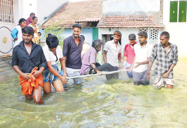
கிச்சிப்பாளையம், கருவாட்டு பாலம், பச்சப்பட்டி, நாராயண நகர், களரம்பட்டி ஆகிய பகுதியில் உள்ள சாலைகளில் தண்ணீர் பெருக்கெடுத்து ஓடியது. இதனால் சாலையில் உள்ள பள்ளம், மேடு தெரியாமல் வாகன ஓட்டிகள் பெரிதும் சிரமத்துக்கு உள்ளானார்கள். தாழ்வான பகுதிகளில் உள்ள வீடுகளில் மழைநீர் புகுந்ததால் பொதுமக்கள் வெளியே வர முடியாமல் சிக்கி தவித்தனர். பச்சப்பட்டி பகுதியில் குடியிருப்புகளை மழைநீர் சூழ்ந்தது. இதனால் வீட்டுக்குள் சிக்கியவர்களை அந்த பகுதி வாலிபர்கள் ஸ்ட்ரெச்சர் மூலம் மீட்டு வந்தனர்.

சேலம் நகரில் ஆயிரக்கணக்கான வீடுகளில் மழை தண்ணீர் புகுந்தது. வீடுகளில் தண்ணீர் புகுந்ததால் அரிசி, பருப்பு உள்ளிட்ட உணவு பொருட்கள் மற்றும் எலக்ட்ரானிக் சாதனங்கள் நனைந்து சேதம் அடைந்தன.

வீடுகள் இடிந்தன

கனமழையினால் சேலம் மணக்காடு பகுதியில் செல்வி, ராஜீவ், லட்சுமி ஆகியோரின் கூரை வீடுகள் உள்பட 5 பேரின் வீடுகள் இடிந்தன. வீட்டிற்குள் இருந்தவர்கள் முன்கூட்டியே வெளியே வந்ததால் அதிர்ஷ்டவசமாக உயிர் தப்பினர். வீடுகள் இடிந்து விழுந்ததால் டி.வி., மிக்சி உள்ளிட்ட பொருட்கள் தண்ணீரில் நனைந்து சேதமானது.

மேலும் மழைநீரை வெளியேற்றும் பணியில் மாநகராட்சி ஊழியர்கள் ஈடுபட்டனர்.

NEET PG 2024 Exam Pattern REVISED, NMC Issues Official Notice; Here’s All You Need To Know

NEET PG 2024 Exam Pattern REVISED, NMC Issues Official Notice; Here’s All You Need To Know The NEET PG 2024 is scheduled to take place on Ju...